Where USDA Zones 7b and 8a Fall in South Jersey and the Coast
South Jersey gardeners often see USDA Zones 7b and 8a close together on the map and wonder which one applies to a yard near the coast. The broad pattern is useful, but a zone color cannot account for every street, slope, or exposed garden bed. Here’s how to read the regional pattern, check your location, and use the result without mistaking it for a planting calendar.
The broad pattern across South Jersey and the coast
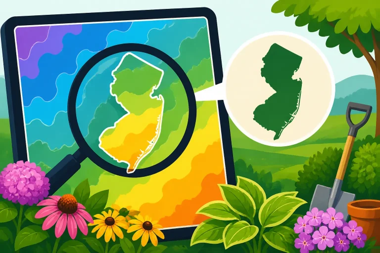
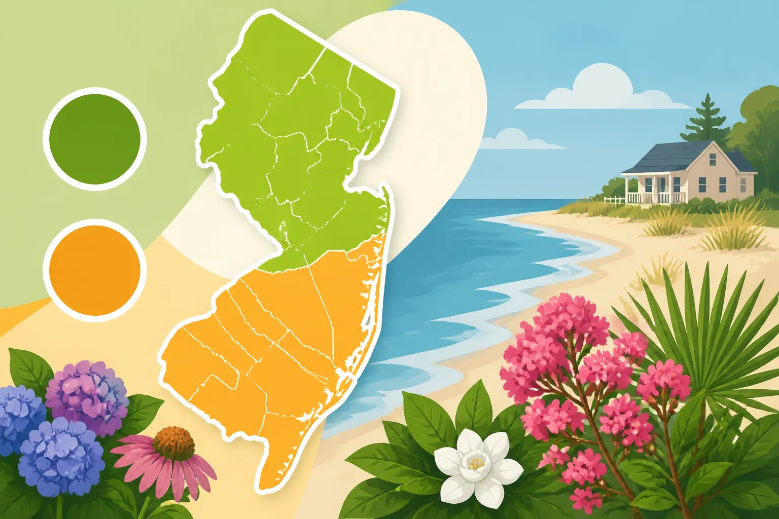
On the USDA Plant Hardiness Zone Map, Zone 7b generally covers much of inland South Jersey, while Zone 8a tends to appear in warmer areas closer to the Atlantic coast and toward the state’s southern tip. The boundary is not a straight line, and it does not follow county borders. Instead, the mapped bands reflect regional winter-temperature patterns, shaped in part by distance from the ocean and by local terrain.
That broad pattern is a starting point, not a reliable way to assign a zone to a particular town or property. A neighborhood near the coast may differ from one farther inland, and two nearby yards can have noticeably different winter conditions. For an individual garden, use the map’s location search rather than guessing from a county name or a nearby town.
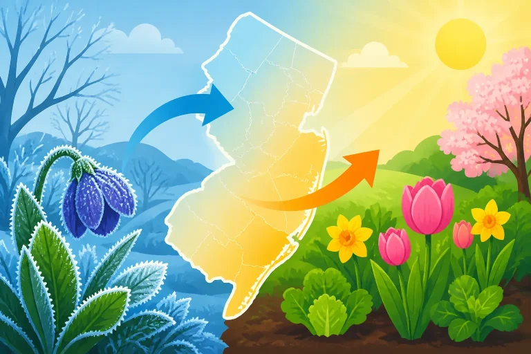
The key regional contrast is that the ocean moderates temperatures along the shore. Water changes temperature more slowly than land, so it can soften some winter cold near the coast. Inland locations are less buffered by the ocean and can experience colder winter conditions. The transition between those influences is gradual and irregular, which is why the map shows bands and small variations rather than a simple “coast versus interior” split.
It helps to picture 7b and 8a as neighboring regional categories, not as two sharply separated climates. A property near the mapped boundary can be close to both colors, but the map still assigns a location to a particular zone. That assignment is useful for comparing plants’ winter hardiness requirements. It does not mean a garden bed will always experience the winter conditions represented by its map color.
For the regional map context, see Where USDA Zones 7b and 8a Fall in South Jersey and the Coast. To understand what a zone label says about a plant, USDA Hardiness Zones: What They Mean for Perennials is a useful companion.
Why the boundary does not follow municipal lines
A municipal boundary is a line drawn for administration, not climate. A town can cover a range of settings: developed blocks, open land, low areas, wooded slopes, and properties closer to or farther from the water. Even if most of a town appears in one zone, a map view at a more detailed scale may show a nearby transition or a different zone for a particular location.
County borders are no better as climate guides. South Jersey spans coastal and inland settings, and a county can include more than one pattern of exposure. A zone lookup based on a ZIP code can narrow the search, but ZIP codes also cover broad areas and should not be treated as exact garden coordinates.
The practical approach is to check the map at the location of the garden, then interpret its result alongside the property’s conditions. If a yard sits near a zone boundary, treat the map classification as a useful baseline rather than a promise that every plant rated for that zone will thrive without protection.
What Zones 7b and 8a tell you—and what they leave out
The USDA Plant Hardiness Zone Map is designed to help gardeners assess whether a perennial plant is likely to tolerate the coldest winter conditions typical of a location. The “a” and “b” divisions separate smaller portions of the broader zone categories. Moving from 7b to 8a signals a shift toward milder winter cold in the map’s measure.
That is meaningful when comparing a perennial’s listed hardiness range with a garden’s zone. A plant rated for a colder zone may be more likely to survive winter in a warmer zone, although survival also depends on the plant’s health, soil drainage, exposure, and care. A plant whose stated cold tolerance is marginal for a site may be at greater risk during a severe winter or in an exposed location.
A hardiness zone is not a general rating for how easy a plant is to grow. It does not tell you whether a plant will tolerate summer heat, wet soil, drought, salt exposure, shade, or strong winds. Nor does it describe the length of the growing season or the exact timing of spring frosts and autumn freezes. Those factors can be just as important as winter cold.
| The map can help answer | The map does not answer |
|---|---|
| Is this plant generally rated for winter cold in this region? | When is it safe to plant tender vegetables outside? |
| Is a location in a milder or colder broad winter category? | How much sun or water will a garden bed receive? |
| Is a perennial’s listed hardiness range worth checking for this site? | Will the plant tolerate salty wind, wet soil, or summer heat? |
| Is a local site close to a regional zone transition? | Will every part of a property experience the same conditions? |
A zone is especially useful for long-lived plants because they remain in place through winter. For annual vegetables, the zone can offer background climate context, but it should not be used by itself to decide when to sow seeds or set out seedlings. A warm-season crop can be damaged by a late cold snap even in an area mapped to a relatively mild zone.
Likewise, a favorable zone does not guarantee that a plant will survive a particular winter. A cold spell can be harsher than the usual pattern, and winter injury can result from wind, drying, saturated soil, or repeated freeze-thaw cycles. A plant that is marginally hardy in a yard may benefit from a sheltered planting site or other suitable protection, but protection cannot correct every mismatch between a plant and its growing conditions.
For more detail on the map itself, see Using the USDA Plant Hardiness Zone Map for Garden Plants. If you are unsure how to locate a property on the digital map, How to Find Your Exact USDA Zone on the Digital Map explains the lookup process.
Why the coast and a single yard can differ from the regional map
Coastal influence is one of the reasons South Jersey has a less uniform zone pattern than a broad regional label might suggest. The Atlantic can moderate winter temperatures near the shore, but that influence varies with distance, exposure, and local geography. A site directly exposed to ocean wind may experience different conditions from a sheltered site nearby. The water’s influence does not erase every cold event, nor does it make the whole coast climatically identical.
The coast can also create trade-offs. A milder winter classification may benefit some perennial plants, but wind exposure can stress plants, and salt spray can limit what grows well in exposed locations. A sheltered coastal yard can be quite different from an open, windy property. Gardeners should consider the actual exposure of a bed rather than assuming that a coastal address automatically provides a protected growing environment.
Inland sites have their own variations. Low spots and hollows can collect cold air, while higher or more exposed ground may experience stronger winds. Buildings, walls, paved areas, and tree cover can alter local temperature and shelter. A garden against a sunny wall may behave differently from an open bed a short distance away, though the wall can also create excessive heat or reduce airflow in other seasons.
Microclimates within one property
A microclimate is a small area whose conditions differ from the surrounding neighborhood. In South Jersey, the difference may come from elevation, slope, wind exposure, nearby water, pavement, buildings, or vegetation. Microclimates do not change the official zone assigned by the map, but they can change how a plant performs in a particular spot.
A few common examples:
- A low garden bed may be more exposed to cold-air pooling than a higher bed nearby.
- A sheltered courtyard may have less wind exposure than an open yard.
- A south-facing wall can create a warmer, sunnier location than a north-facing wall.
- Pavement and masonry can hold and release heat, changing the conditions close to them.
- An exposed coastal bed can face more wind and salt than a protected garden farther from the water.
These influences can help explain why a plant survives in one corner of a yard but struggles elsewhere. They are not a reason to disregard the map; they are additional information for choosing where to plant. Microclimates and Zone Discrepancies Across New Jersey Yards looks more closely at why nearby gardens can behave differently.
Soil is another part of the picture, even though it does not determine the map zone. Coastal and inland properties can differ in drainage, moisture retention, and soil texture. Sandy soil may drain quickly and warm more readily, but it can also dry out faster. Heavier or poorly drained soil can hold water and create conditions that roots do not tolerate. A plant that is winter-hardy may still fail if the soil stays too wet or becomes too dry.
Before choosing a planting site, observe it over time. Note where water collects after rain, which areas dry first, where strong wind reaches plants, and which spots receive sun at different times of day. A map can suggest the broader winter climate; those observations help match a plant to the conditions it will actually experience.
How to check the zone for your own garden
Start with the USDA Plant Hardiness Zone Map’s location search and use the most precise location information available. A street location can be more useful than a ZIP code, but do not interpret the result as a measurement of every corner of the property. The map is a regional tool, not a yard-by-yard temperature sensor.
A practical way to use it is:
- Search for the garden location on the digital map. Use the map’s location function rather than relying on a town’s general reputation or an old gardening calendar.
- Read the color at the garden site. Check whether it falls in 7b, 8a, or another category shown by the current map.
- Notice whether the location is near a color boundary. A boundary is a signal to be thoughtful about marginally hardy plants, not proof that the map is wrong.
- Compare the plant’s stated hardiness with the mapped zone. Check the plant tag or reliable growing information, including whether the rating describes winter survival.
- Consider the bed’s exposure and soil. A sheltered, well-drained bed and an exposed, low-lying bed can produce different outcomes within the same mapped zone.
- Keep notes on what survives. Record winter losses, damage, and successful plantings. Your observations can help refine future choices without replacing the map’s broader reference.
If two map views seem to disagree, check that they use the same USDA map version and that you are viewing the correct location. Older maps may display a different pattern from the current map. Online summaries can also simplify regional boundaries or use a ZIP code as a substitute for a more precise lookup. For a second method of checking, see How to Check Your New Jersey Hardiness Zone by ZIP Code and Finding Your Exact Zone and Freeze Dates Using Your ZIP Code.
When a location appears very close to a boundary, avoid treating the zone as a guarantee for a plant near its cold limit. Consider choosing a plant rated for colder winter conditions if reliable survival is more important than experimenting. If you do try a marginal plant, select a sheltered spot and be prepared for the possibility of winter damage or loss.
Using 7b or 8a to choose plants
For perennials, trees, and shrubs, use the zone rating as an initial filter. If a plant’s winter hardiness comfortably includes the zone shown for your site, it may be a reasonable candidate, provided the rest of its needs fit. If the plant is rated only for milder conditions than the map indicates, its survival may be less dependable, especially in exposed or cold-prone parts of the yard.
For a garden close to the 7b–8a transition, there are two sensible approaches. Gardeners who want reliability can favor plants with enough cold tolerance to handle the less-mild side of the local pattern. Gardeners who enjoy testing a wider range can try a plant suited to a slightly warmer setting, while treating it as a calculated risk. Neither approach is automatically better; the right choice depends on whether a plant’s survival or experimentation matters more.
Do not make the zone the only selection criterion. A plant’s light, soil moisture, drainage, mature size, and exposure requirements still matter. A plant suited to the mapped zone may fail in shade if it needs full sun, in wet soil if it needs sharp drainage, or in a windy coastal location if it cannot tolerate exposure. A list of hardy plants is useful only when those plants also fit the site.
When reading a plant label or catalog, check what “hardy” means in context. It generally refers to the plant’s ability to withstand winter conditions, not to dependable flowering, fruiting, or performance in every local microclimate. A plant can survive winter but grow poorly in a site that does not provide its preferred moisture, light, or summer conditions.
Choosing plants near the zone boundary
If your garden is close to the boundary, build a mix of dependable choices and a few experiments rather than making the whole landscape depend on marginal plants. This keeps the garden resilient while allowing you to learn what your site can support. When possible, use established local observations to supplement labels, but remember that results from a sheltered yard may not transfer to a windy or exposed one.
For ornamental planting, local suitability involves more than survival. Consider whether a plant can establish well, remain healthy through summer, and fit the available space as it matures. For native plants, local soil, moisture, and habitat conditions matter alongside winter hardiness. Matching Native New Jersey Plants to Your Soil and Light offers a useful way to think through those site factors.
For vegetables, hardiness zones are even less useful as a calendar. Many vegetables are annuals, and their planting success depends on soil and air temperatures, frost risk, and the crop’s tolerance of cold or heat. Use a regional planting schedule and local freeze information rather than deciding from the zone label alone. Month-by-Month Planting Windows Across New Jersey Regions connects seasonal timing to regional differences.
Why a zone is not a planting calendar
A map zone describes a winter-hardiness pattern. It does not say when the last spring frost will occur, when soil will be warm enough for sowing, or when a fall freeze will end the growing season. Those dates and conditions vary from year to year and across New Jersey.
That distinction matters most for tender crops. Tomatoes, peppers, squash, and other warm-season plants can be damaged by cold conditions even when they are grown in a location mapped to 8a. A milder zone does not remove the risk of a late spring chill. Similarly, a warm autumn day does not guarantee that a crop will have enough time to mature before a later freeze.
For planting decisions, combine three types of information:
- Hardiness zone for the broad winter context, especially for perennial plants.
- Local frost and freeze probabilities for the seasonal risk of cold.
- Crop-specific requirements such as soil temperature, days to maturity, and tolerance of cool conditions.
Frost dates are estimates based on probabilities, not fixed promises. A date that describes a given probability of frost can help with planning, but an individual year may bring frost earlier or later. Use local freeze information and short-term forecasts when deciding whether to protect plants or delay a sensitive planting. First and Last Frost Dates Across New Jersey Regions and How to Look Up Local Freeze Probabilities Across New Jersey address the timing question more directly than a hardiness zone map.
For seeds, the difference between direct sowing and starting indoors also depends on crop type and the local season. Some crops tolerate cool conditions and can go into the ground earlier; others need warmer conditions or a protected start. See Starting Seeds Indoors vs Direct-Sowing in New Jersey for a broader comparison, and When Tender Crops Can Safely Move Outdoors in New Jersey for transplant decisions.
A practical seasonal planning sequence
Rather than planning from the zone number alone, work through the season in order:
- Check the map zone for perennial choices. Use it to screen for winter hardiness, then check the plant’s other needs.
- Identify your garden’s local conditions. Note sun, wind, drainage, and areas where cold air or water may collect.
- Use local frost information for spring and fall. Treat published dates as probabilities and adapt to the forecast and observed conditions.
- Follow crop-specific planting guidance. Cool-season crops and warm-season crops have different tolerances.
- Protect or delay vulnerable plants when conditions call for it. A map zone cannot substitute for responding to an actual cold forecast.
- Review the season afterward. Note what was damaged, what matured, and which beds were warmer or colder than expected.
This sequence keeps the zone in its proper role. It is useful for making a first pass at perennial plant selection, but local weather and crop needs should guide planting dates.
Common mistakes when interpreting South Jersey zone maps
Treating a ZIP code as the whole answer
A ZIP code can return a useful general location, but it may cover a large area. A result should be treated as a starting point, especially if the garden is near a coastal transition or a mapped zone boundary. Use a detailed map search where possible, then consider the actual conditions of the property.
Assuming the coast is uniformly warmer
The ocean can moderate winter conditions, but it does not make every coastal property equally warm or sheltered. Exposure, wind, distance from open water, and the layout of the yard matter. A site near the shore can be mild in one respect and challenging in another, particularly where wind or salt exposure is significant.
Assuming Zone 8a means warm-season crops can go out early
The zone category does not give a last frost date or soil temperature. Tender plants still need suitable growing conditions. A warm spell can be followed by a cold night, so use frost probabilities and forecasts instead of treating the zone as permission to plant.
Assuming a plant rated for the zone will thrive
Hardiness describes winter survival potential, not every aspect of plant performance. Soil moisture, drainage, light, heat, pests, and wind can still make a site unsuitable. If a plant repeatedly struggles despite being labeled hardy for the area, investigate those other conditions before concluding that the zone map is inaccurate.
Using an old map or a broad regional label
A zone remembered from an older map, a nursery conversation, or a general article may not match the location shown on the current map. Check the map directly and use the result for the garden’s actual location. Broad labels such as “South Jersey” or “the shore” are useful for orientation, but too broad for a precise plant choice.
The most dependable interpretation is straightforward: 7b and 8a describe adjacent winter-hardiness categories, and the broad pattern generally shifts toward milder conditions closer to the coast. The exact map color for a garden should be checked directly, then combined with local exposure, soil, and seasonal frost information.
Frequently Asked Questions
Is all of South Jersey in Zone 7b?
No. The region includes different mapped patterns, and Zone 8a tends to appear in warmer coastal areas. Check the USDA map for the garden location rather than assuming one zone covers all of South Jersey.
Is the Jersey Shore all in Zone 8a?
No. The coast is not a single uniform zone. The mapped pattern varies by location, and coastal exposure can also make garden conditions differ from one property to another.
Does Zone 8a mean I can plant vegetables earlier than in Zone 7b?
Not necessarily. The zone map does not provide planting dates or predict the last spring frost. Use local frost probabilities, current forecasts, and guidance for the specific crop.
Which zone should I use if my yard is near the 7b–8a boundary?
Use the USDA map’s result for the garden location as the baseline. For a plant close to its cold-hardiness limit, favor the more conservative choice or treat a warmer-zone plant as an experiment, particularly in an exposed or low-lying spot.
Disclaimer
This article is for general informational purposes only and does not constitute professional advice. Laws, prices and regulations vary by location and change over time. Consult a qualified professional for guidance on your specific situation. New Jersey Gardening Guide is not a government agency and is not affiliated with any university extension, state department of agriculture or other government agency.