How to Find Your Exact USDA Zone on the Digital Map
Finding your USDA hardiness zone can help you choose plants suited to winter conditions, but a ZIP-code result may not reflect the exact spot where you garden. This guide explains how to use the digital map to locate your property, read its zone, and account for the local conditions the map cannot show.
What the USDA Plant Hardiness Zone Map tells you
The USDA Plant Hardiness Zone Map is a tool for comparing the winter cold a location typically experiences with the cold tolerance of perennial plants. Its zones describe average annual extreme minimum winter temperatures. They can help you screen plant choices, but they do not predict the weather in a particular winter or guarantee that a plant will thrive in your yard.
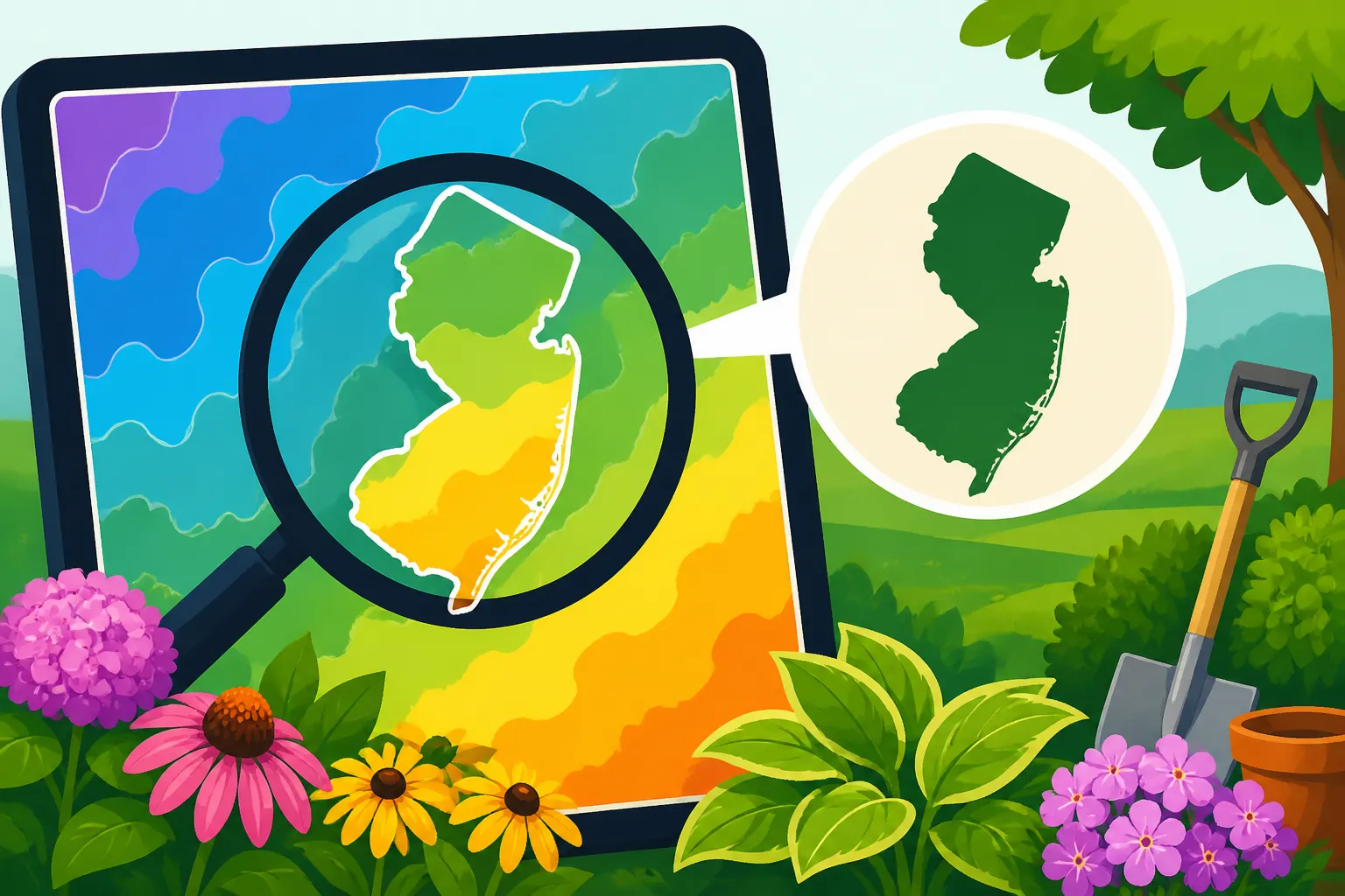
The USDA Agricultural Research Service describes the 2023 USDA Plant Hardiness Zone Map as GIS (Geographic Information System)-based and designed for the Internet. A GIS map places geographic information over locations on a map, making it possible to inspect conditions at a more local scale than a broad regional summary.
A zone is best treated as a starting point. It helps answer whether a plant is generally suited to the winter cold associated with a mapped area. It does not tell you whether a plant will get enough sun, whether the soil drains well, how exposed the site is to wind, or when it is safe to plant tender vegetables outdoors.
That distinction matters in New Jersey, where a ZIP code may cover places with different landscapes and growing conditions. A map result can be useful for comparing plant hardiness, but the growing conditions of a garden bed may differ from the regional pattern. A sheltered spot near a building, a windy open yard, and a low area that collects cold air can all behave differently.
It also helps to separate hardiness zones from frost dates and planting calendars. A hardiness zone is about winter cold and perennial plant suitability. Frost information is used to judge seasonal risks, particularly for plants that cannot tolerate a freeze. If you are planning a vegetable garden, use zone information alongside local frost guidance and crop-specific planting advice, rather than treating the zone as a calendar.
For more on the map’s role in plant selection, see Using the USDA Plant Hardiness Zone Map for Garden Plants. If you are choosing perennials, USDA Hardiness Zones: What They Mean for Perennials explains how hardiness fits into that decision.
How to find your property on the digital map
The most useful result comes from locating the garden itself as closely as the map allows. A ZIP-code lookup can be a convenient first step, but it may represent a broader area than your property. When the map provides a way to search or navigate to a location, use the specific property location rather than assuming the ZIP-code result applies everywhere in the postal area.
A careful map check follows a simple sequence:
- Open the USDA Plant Hardiness Zone Map through the official USDA site. Confirm that you are viewing the official map, not a third-party planting calendar or an older map reproduced elsewhere.
- Search for the property location if the map provides a search field. Use a street address or another location detail that identifies the garden more precisely than a broad regional label.
- If search is unavailable or does not identify the right place, navigate visually. Move to the general area, then zoom toward the property until the map gives enough detail to compare the location with the zone boundaries.
- Check the marker or point against the map itself. If a search places a marker in the wrong part of town, correct the location before recording the result.
- Read the zone shown for the property location, including any letter suffix. Write down the result exactly as displayed, then confirm it against the map rather than relying only on a search summary.
The map interface may change, so focus on the result rather than memorizing a particular button or menu. The important question is whether the point you are reading corresponds to the garden, not merely whether the site has returned a zone after a search.
If the property has several growing areas, check each one separately when the map’s level of detail makes that possible. A front bed, backyard plot, and container area may be in the same mapped zone but still have different exposure, shelter, or drainage. The map’s label describes the broad winter-hardiness context; it is not a fine-scale measurement of every bed.
Keep a note of the location used for the lookup. If you later compare gardening advice, you can tell whether the advice refers to your specific property, a ZIP code, a nearby town, or a larger part of New Jersey. This is especially helpful when an online source gives a zone without explaining how it assigned that zone.
For a ZIP-code-based approach and its limitations, see How to Check Your New Jersey Hardiness Zone by ZIP Code. It complements a property-level map check but should not replace looking at the location itself when greater precision matters.
Read the result carefully, including its limits
The zone label is a classification, not a forecast. It does not say what the coldest temperature will be in an upcoming winter, how often a damaging cold spell will happen, or whether a particular plant will survive every winter. It also does not describe summer heat, rainfall, soil moisture, or the length of a crop’s growing season.
When reading the map, pay attention to the full label rather than stopping at the main zone number. A letter suffix is part of the displayed zone information and can distinguish locations within a broader zone. Copy the complete label as shown. If a nursery tag or plant reference uses a different format, compare the formats carefully instead of assuming that a shortened label means the same thing.
A common source of confusion is a mismatch between a digital map result and a plant tag, gardening book, or older map. Before deciding that one is wrong, check whether both refer to the same location and the same version of the map. A source may use a ZIP-code center, a town name, or a regional estimate instead of your property. It may also be using an older map or a general range intended for a broad area.
The map is most useful for eliminating clearly unsuitable choices and identifying plants that are plausible candidates for your winter conditions. It is less useful as the sole basis for a high-stakes planting decision. A plant’s survival also depends on its health, establishment, soil, exposure, and care. A plant listed as suitable for a zone may still struggle in a wet, windy, exposed, or poorly drained bed.
Use the result alongside information about the plant itself. Check whether it needs a particular soil type, sunlight exposure, moisture level, or protection from wind. If it is a perennial, consider whether the root area is likely to remain wet or become exposed to repeated temperature swings. If it is a vegetable, determine whether it is a cool-season or warm-season crop and use a planting calendar based on local seasonal conditions.
That last distinction is important: a hardiness zone does not tell you when to sow seeds or transplant vegetables. A plant may be hardy enough to survive winter but still be sensitive to spring frost while young. Conversely, a cool-season crop may tolerate chilly conditions even when frost remains possible. For those decisions, use crop-specific New Jersey guidance such as When Tender Crops Can Safely Move Outdoors in New Jersey and Planning Your New Jersey Vegetable Garden From Site to Harvest.
If the mapped label is unexpected, do not change it based only on how mild or cold one winter felt. The map is a regional planning tool, while a single season can depart from typical conditions. Recheck that the pin is on the correct property and that you are reading the current official map. Then consider whether local features help explain why the garden itself seems warmer or colder than the broader map suggests.
Why a ZIP code may not give your exact garden zone
A ZIP code is useful for finding a general area, but it is not a precise description of every growing site within that area. It may cover neighborhoods with different elevation, proximity to water, building density, vegetation, and exposure. Those differences can influence how a garden experiences cold, even when the mapped zone is the same across much of the area.
A ZIP-code lookup can also return a location that represents the postal area rather than the garden. If a map uses a representative point for a search, that point may not be near your home. A result can therefore look exact because it includes a zone label, while still being tied to a general location rather than the bed where you plan to plant.
To improve the lookup, search at the property level when possible and visually confirm the map point. If the address cannot be placed precisely, use a nearby recognizable location and inspect the surrounding map carefully. Do not assume that a town name or postal area captures the conditions of every yard within it.
Compare the result with the actual setting, but do not use visual impressions to rewrite the map label. If the map shows a boundary near the property, record the displayed result for the point you checked and note the uncertainty. A boundary close to a property can make a generalized ZIP-code answer especially unhelpful; a map lookup at the garden location is the better basis for choosing a label.
For a broader explanation of why nearby yards can differ, see Microclimates and Zone Discrepancies Across New Jersey Yards. That topic is particularly useful if your garden seems to behave differently from the zone suggested by a nearby address or regional planting guide.
| Lookup method | What it can help you do | What to check |
|---|---|---|
| ZIP-code search | Locate a general area quickly | Whether the result represents your property or a broader postal area |
| Address search | Place the map closer to the garden location | Whether the marker lands on the correct property |
| Visual map inspection | Check nearby zone boundaries and correct a misplaced search result | Whether you are reading the point where you actually garden |
| Local garden observation | Notice shelter, exposure, drainage, and cold-air patterns | Remember that these conditions do not change the map’s label |
| Plant tag or regional guide | Compare a plant’s stated hardiness with the map result | Whether the reference uses the same location and map version |
When the map and your experience do not seem to agree, treat the mismatch as a reason to investigate the site rather than as proof that either source is useless. The map provides a standardized regional reference. Your observations can help explain how a specific planting area performs within that context.
Account for microclimates after checking the map
A digital map can locate your property within a broad hardiness pattern, but it cannot fully describe the conditions beside a foundation, under a tree canopy, on a slope, or in a low corner of the yard. These small-scale differences are often called microclimates. They help explain why plants in neighboring yards, or even different parts of one property, may respond differently to winter conditions.
Shelter can make a location less exposed to cold wind. A wall, hedge, or other structure may reduce exposure, but the effect depends on the site and the plant’s needs. A sunny wall can also create warmer daytime conditions that may encourage early growth, leaving tender new growth vulnerable if cold returns. A sheltered spot is not automatically a safer spot for every plant.
Open areas may be more exposed to wind and sudden temperature changes. Low spots can collect cold air, particularly when conditions are calm. Slopes, nearby buildings, pavement, tree cover, and the direction a bed faces can also affect local warmth and moisture. These effects are not a replacement for the zone map; they are extra context for choosing where and what to plant.
Observe the yard over time instead of relying on a single cold night or one unusually mild season. Note where snow lingers, where the soil tends to stay wet, where plants emerge early, and where cold damage appears more often. These observations can help with site selection and plant care, but they do not turn a local observation into a revised official zone.
If a garden is near a mapped boundary, it can be tempting to select whichever label seems most favorable. Resist choosing a zone based on the plant you hope to grow. Use the map result for the location, then make the planting decision with an honest view of the site’s exposure and the plant’s tolerance. For a less hardy plant, choosing a protected location or providing suitable care may be more sensible than treating the warmer nearby map area as your own zone.
Microclimates also matter when using planting calendars. A cold-air pocket may experience frost differently from a sheltered urban yard, while a sunny spot near a building can warm earlier in spring. That does not mean a hardiness zone predicts the last spring frost. For guidance on seasonal timing, see Why Last Spring Frost Shifts Six Weeks Across New Jersey and How to Look Up Local Freeze Probabilities Across New Jersey.
The practical approach is to keep the map result and your site notes separate. Record the mapped zone as the regional reference. Then note local features that may affect a particular bed. This makes it easier to choose plants without confusing a property’s map classification with the behavior of a specific corner of the yard.
Use your zone result to choose plants and plan a garden
Once you have the mapped zone for the garden location, use it as a filter in plant selection. Compare the plant’s stated hardiness with the result, then look beyond the label. A plant’s hardiness rating does not tell you whether it will suit the soil, light, moisture, or available space in your yard.
For perennials, trees, and shrubs, check the plant’s preferred conditions and mature size as well as its hardiness. A plant can be winter-tolerant yet poorly suited to a shaded, waterlogged, or exposed site. Conversely, a plant with suitable growing requirements may need a more protected location if it is near the edge of its stated hardiness range.
For vegetables, the zone is only one part of the planning process. It may provide general context for perennial crops, but annual vegetable crops are usually timed around season, temperature, frost sensitivity, and days to harvest. A zone lookup does not tell you when to sow peas, set out tomatoes, or protect a seedling from a cold night. Use New Jersey crop-specific planting information for those choices.
Make a short record that keeps the information distinct:
- The mapped zone for the garden location, copied exactly as displayed.
- The location used to find the result, such as the property address or a map point.
- Any uncertainty caused by a nearby zone boundary or imprecise search.
- Site conditions that could affect plant performance, such as wind exposure, shade, drainage, or a low spot.
- The plant information you still need to check, including light, soil, moisture, and seasonal timing.
This record can prevent a common mistake: treating a zone label as a complete growing plan. If a plant fails, the cause may be poor drainage, drought, disease, inadequate light, a late freeze, or unsuitable care rather than an incorrect zone. Likewise, success with a plant does not prove that the map result is wrong; a protected microclimate may help that plant survive.
When using a nursery tag, catalog, or online plant description, check whether the hardiness information is expressed as a range and whether that range matches the map label you recorded. If the reference is vague, seek a more specific plant description rather than assuming that every plant with a similar common name has the same tolerance.
For a broader garden plan, combine the zone result with your site assessment and local planting windows. Month-by-Month Planting Windows Across New Jersey Regions can help with seasonal decisions, while Starting Seeds Indoors vs Direct-Sowing in New Jersey can help you choose a seed-starting approach. For crops that are vulnerable to late cold, use the guidance in Protecting Tomato Transplants From a Late New Jersey Cold Snap.
Common mistakes when reading the digital map
Treating the ZIP-code result as the property result. A ZIP code can point you toward the right area without identifying the exact garden. Search by property location when possible, then inspect the point on the map.
Recording only part of the zone label. If the map displays a letter suffix, include it. A shortened label can make later comparisons confusing, especially when a plant reference uses more detail.
Using an unofficial map without checking its basis. A third-party site may summarize a region or use a different map version. Confirm important decisions against the official USDA map and note the location you checked.
Assuming that the zone predicts frost dates. Hardiness zones and frost timing answer different questions. Use freeze or frost information for seasonal decisions, rather than trying to infer a planting date from the zone.
Assuming a suitable zone guarantees success. The zone does not evaluate soil, sunlight, drainage, watering, pests, or care. Check the plant’s other requirements before planting.
Choosing a warmer result because it makes a desired plant seem safer. The useful result is the one associated with the garden location, not whichever nearby label is more appealing. If a plant is marginal for the mapped conditions, consider site exposure and a more suitable alternative.
Mistaking garden observations for a new map classification. Your yard can be warmer or colder than the surrounding area because of shelter, slope, buildings, or cold-air movement. Record those effects as local conditions rather than changing the mapped label.
Using a hardiness zone as a complete planting calendar. The zone is not a sowing schedule. Check crop-specific guidance for spring and fall timing, especially for tender plants and vegetables.
If the map result seems surprising, retrace the lookup before changing your plant plan. Verify that you selected the correct location, read the full label, and used the official map. Then consider local conditions and plant requirements. This approach gives you a useful answer without asking the map to predict more than it is designed to show.
Frequently Asked Questions
Can a ZIP code tell me my exact USDA zone?
A ZIP-code lookup is a useful starting point, but it may represent a broad area rather than your specific garden. Check the property location on the map when possible and confirm where the search marker lands.
Does my yard have a different zone from the map?
The mapped zone is the regional reference for the location you checked. Local shelter, exposure, slope, buildings, and cold-air movement can affect how a particular bed performs without changing the map’s label.
Does the hardiness zone tell me when to plant vegetables?
No. The zone helps with plant hardiness, especially for perennial plant choices. Vegetable timing depends on the crop and seasonal conditions, so use a New Jersey planting calendar and frost guidance.
What should I do if the map result and a plant tag disagree?
Check that both refer to the same location and map basis, and confirm the complete zone label. Then review the plant’s specific hardiness and site requirements before deciding whether it is suitable.
Sources
- USDA Agricultural Research Service — Map Creation | USDA Plant Hardiness Zone Map (checked November 15, 2026)
Disclaimer
This article is for general informational purposes only and does not constitute professional advice. Laws, prices and regulations vary by location and change over time. Consult a qualified professional for guidance on your specific situation. New Jersey Gardening Guide is not a government agency and is not affiliated with any university extension, state department of agriculture or other government agency.